Flood

ACCCRN Networking Event: Building Resilience Beyond Boundaries

Takeaways Author: Farraz Theda, Nyoman Prayoga

According to BNPB (Indonesian National Board for Disaster Management), more than 93% of disasters in Indonesia are hydrometeorological disasters. Out of 2,341 disaster events, 787 were caused by flooding. Some of the affected areas share the same watershed, which has proved to share trans-boundary waters that are facing increasing demands for basin development collaboration.


Watershed Management, Why the Trans-boundary Governance is Crucial?

Takeaways Author: Farraz Theda, Denia Syam

By 2050, the United Nations predicts 64% of Asia’s population will live in urban settings. With growing population and rapid urban growth, most Asian countries are now facing the consequences of the unplanned urbanization, where open green spaces and wetlands are now covered in cityscapes. Therefore, heavy rain has nowhere to go, and floods are continuing become a major challenge for the countries in the region.


Catalyzing Multi-Stakeholder Partnership to Manage Flood

Stories from the field Author: Anggieta Dwi S., Farraz Theda

Despite infrastructure development through normalized flood canal, improved drainage system and built Jatibarang reservoir that has been done by Semarang's government, the city continues to be at a great risk of flooding because of climate change and urbanisation. Zurich Flood Resilience Program improved the capacity of the communities who live in flood prone areas.


Looking Beyond Infrastructure to Address Flooding in North Jakarta

Stories from the field Author: Intan Hapsari Surya Putri, Farraz Theda

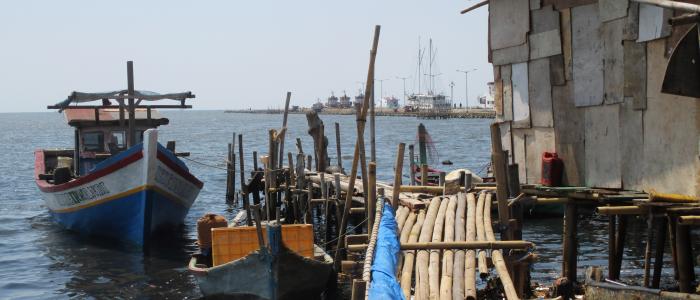
Penjaringan is one of the most historic areas of Indonesia’s capital, Jakarta. As a coastal area, Penjaringan Sub-district in North Jakarta is constantly suffering from flooding because of high tides. Muara Angke, which is in a part of Penjaringan known as Pluit, is among those most at risk of facing tidal floods. ‘Muara Angke’ in Indonesian means the mouth of the River Angke. It is widely known for its port and the fishery sector (i.e. fishing, processing, trading) is the main livelihood for community living there.


Improving Community Preparedness along Semarang Flood Canal

Stories from the field Author: Nyoman Prayoga, Mega Anggraeni, Farraz Theda

Semarang deals with various physical challenges due to its geography as a coastal city; it is known specifically for its frequent floods. There are 21 rivers located in Semarang, creating a high risk of flooding. In response to that, Semarang City Government has carried out several actions to reduce flood risk through the construction of Jatibarang reservoir, normalization of Semarang Flood Canal, and also improvement of the drainage system.